 "Jonathan Harper" (jbh)
02/25/2015 at 20:07 • Filed to: road trips, jbh, help
 4
4
 43
43|
"Jonathan Harper" (jbh)
02/25/2015 at 20:07 • Filed to: road trips, jbh, help | 4
| 43 |
I'm planning a road trip. It needs to be the most scenic, amazing, and beautiful route. Dirt roads are fine. I'm looking for the hidden gems. The diamond in the rough.
I'll go pretty much anywhere within the continental USA. Please include a map of the road as well as a photo example of the scenic, amazing, and beautiful sights to be seen.
 Desu-San-Desu
> Jonathan Harper
Desu-San-Desu
> Jonathan Harper
02/25/2015 at 20:14 |
|
Are you planning on coming near the Carolina/Tennessee junction?
 norskracer98-ExploringTheOutback
> Jonathan Harper
norskracer98-ExploringTheOutback
> Jonathan Harper
02/25/2015 at 20:15 |
|
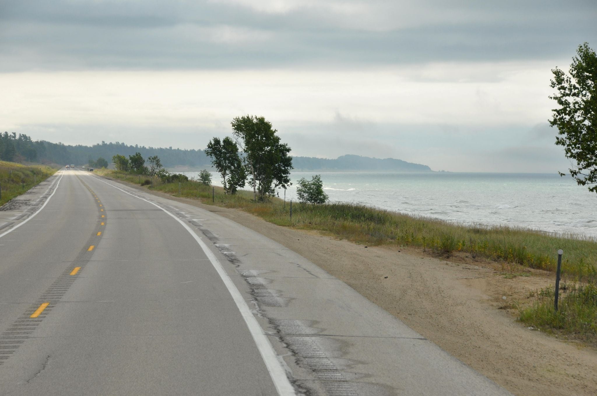
Going-to-the-Sun Road in Glacier National Park, West Glacier, Montana.
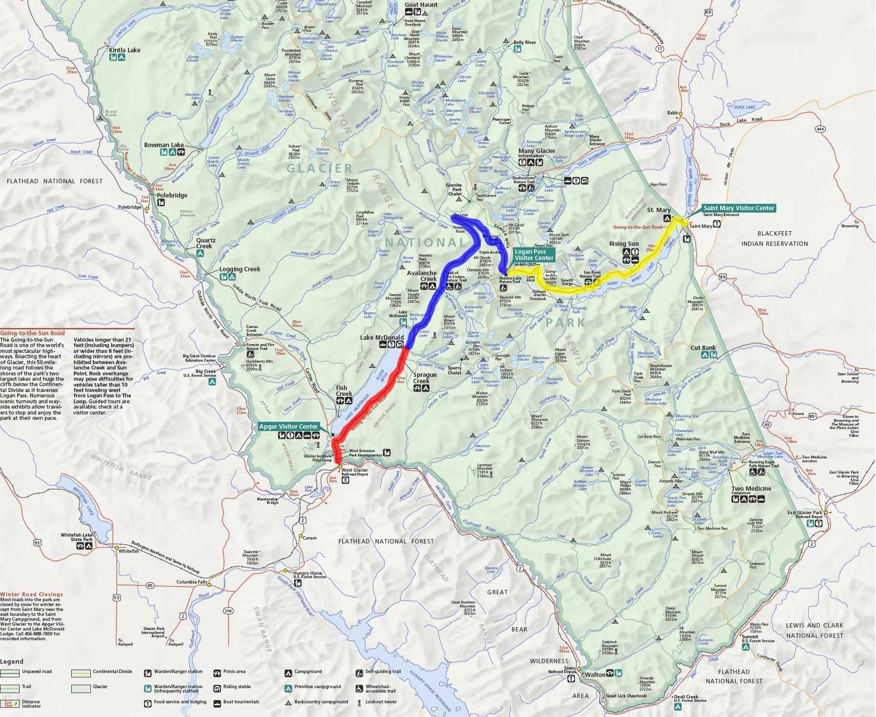
Map
and scenic views you say?
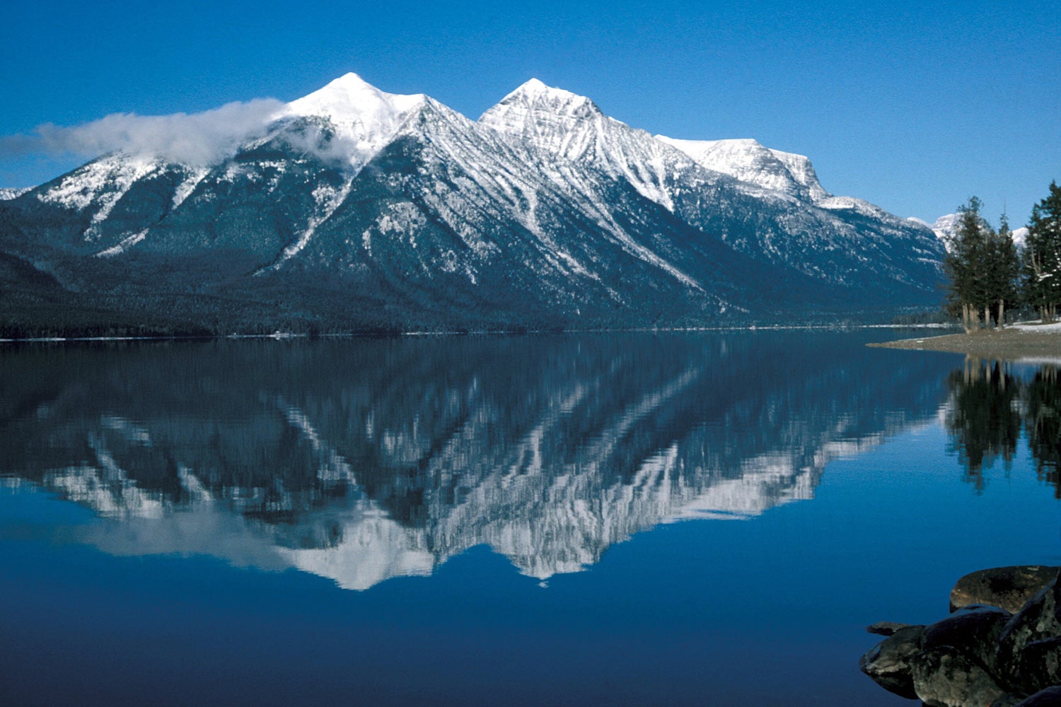
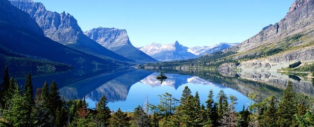
I highly recommend the Red Bus tour. It was very interesting all day ride. Starts at like 9 AM and ends around 5 PM. Road is only open fully from like June to August so kinda limited window.
 BrianGriffin thinks “reliable” is just a state of mind
> Jonathan Harper
BrianGriffin thinks “reliable” is just a state of mind
> Jonathan Harper
02/25/2015 at 20:17 |
|
If you're travelling around Albuquerque, take NM 165 from Tijeras to Placitas (if you have a high ground clearance vehicle). Not so much dirt as rock road, it's a short hop that takes you around a beautiful part of the Sandias.
 V8soundRIOT- Now Has a V8
> Jonathan Harper
V8soundRIOT- Now Has a V8
> Jonathan Harper
02/25/2015 at 20:22 |
|
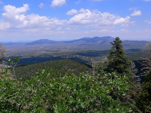
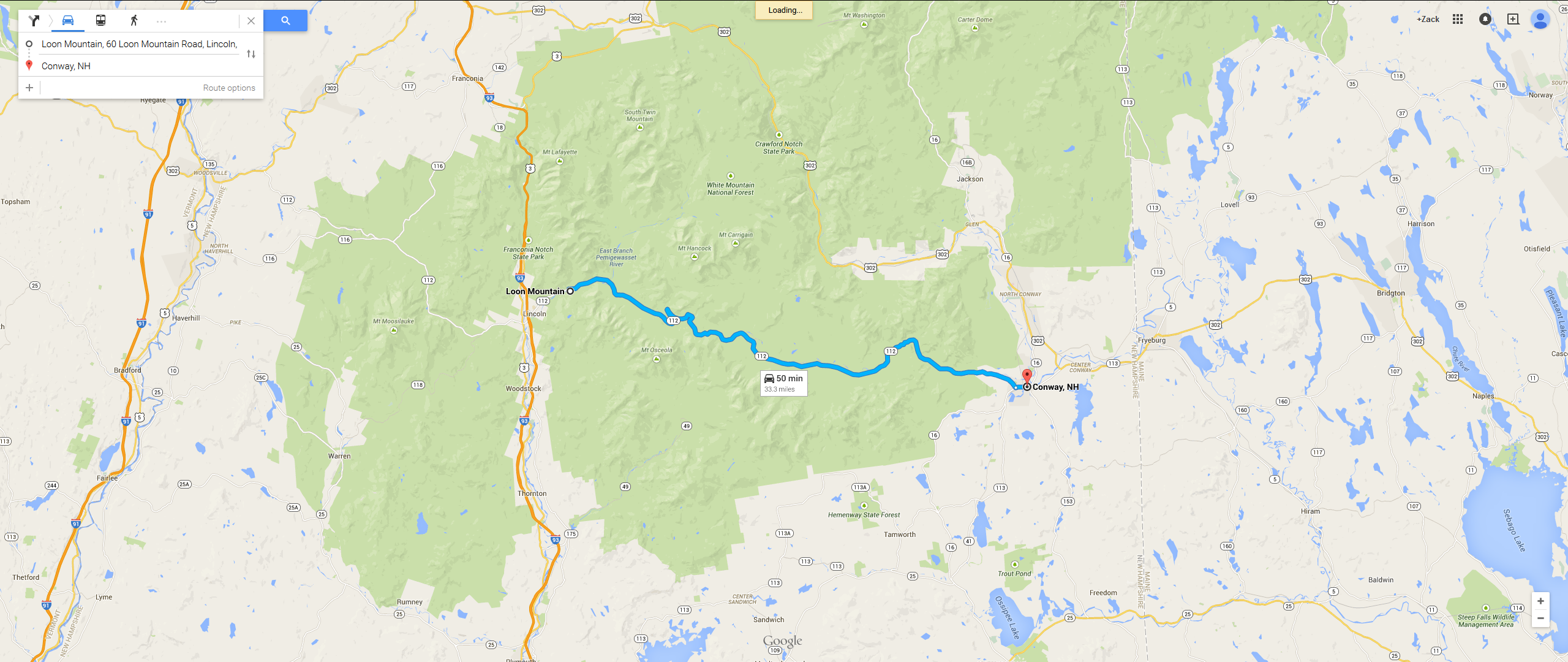
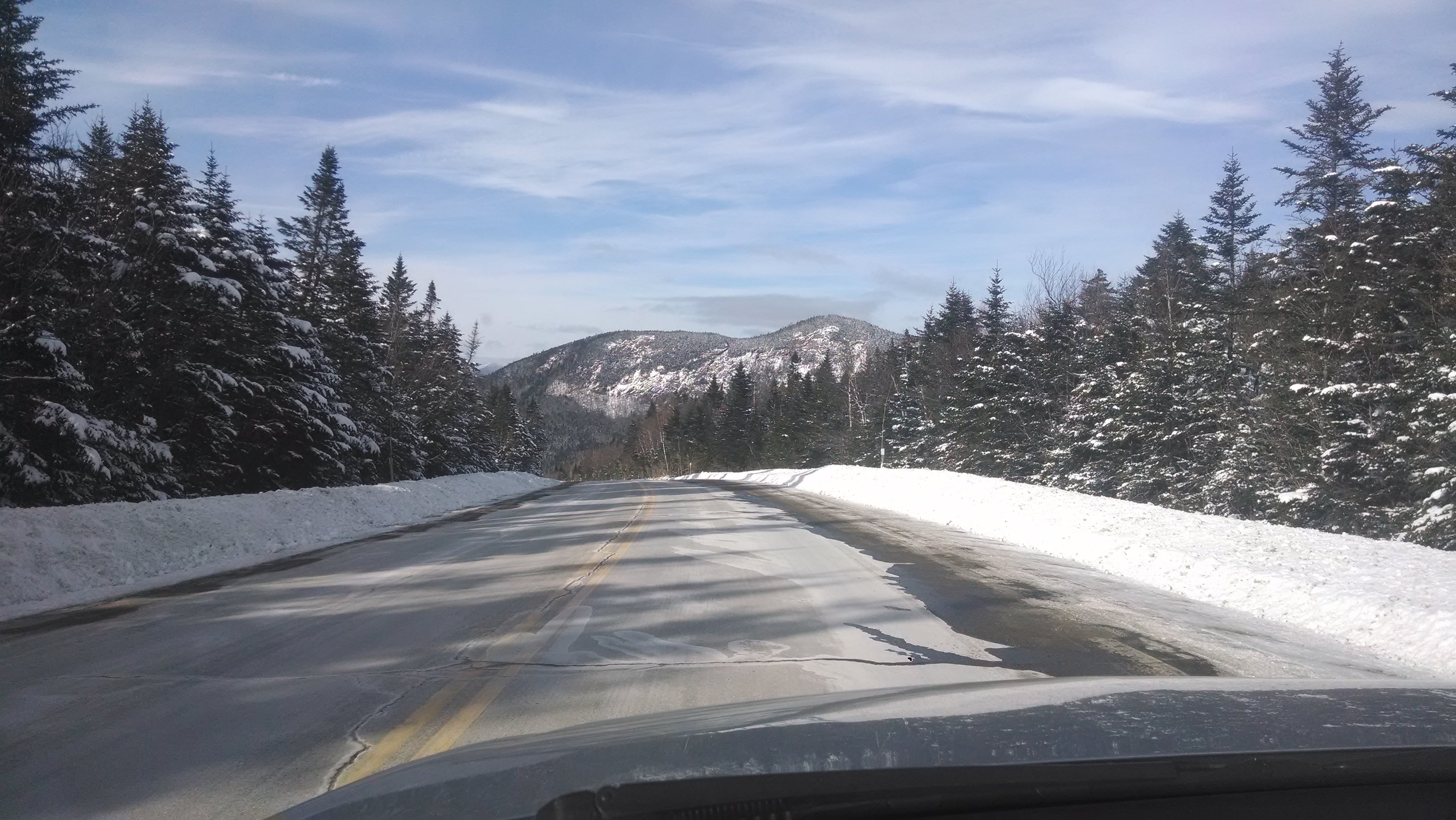
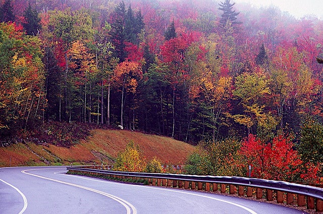
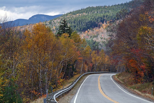
Kancamagus in New Hampshire, it's kind of butt clenching when it is snowing, but the views are worth it. If you go into New Hampshire during the summer, driving up the Mount Washington Auto Road has plenty of scenic views (none of these are my pictures)
 Leadbull
> Jonathan Harper
Leadbull
> Jonathan Harper
02/25/2015 at 20:23 |
|
Illinois Rte. 165, in Sibley, IL.
!!! UNKNOWN CONTENT TYPE !!!
!!! UNKNOWN CONTENT TYPE !!!
Beautiful, isn't it?
 marshknute
> Jonathan Harper
marshknute
> Jonathan Harper
02/25/2015 at 20:33 |
|
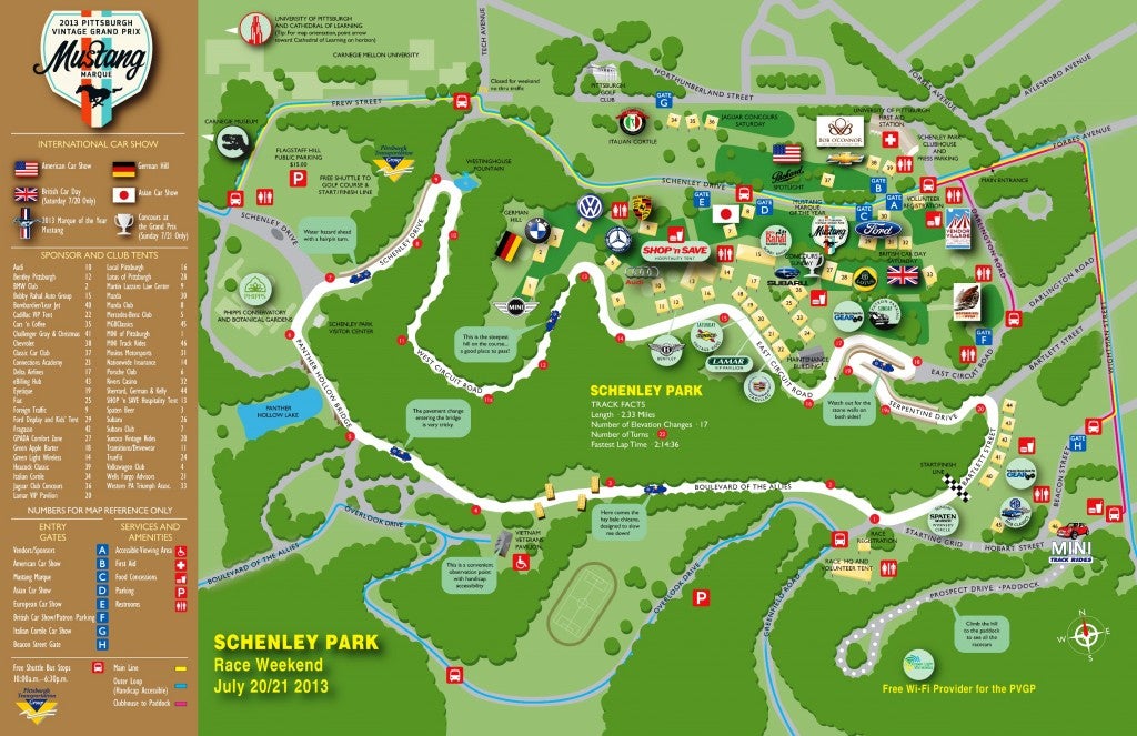
The roads in Pittsburgh's Schenley Park are fantastic driving roads:
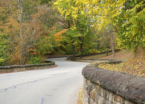
It's no wonder that they are home to the annual Pittsburgh Vintage Grand Prix.
 saabstory | fixes bikes, breaks cars
> Jonathan Harper
saabstory | fixes bikes, breaks cars
> Jonathan Harper
02/25/2015 at 20:36 |
|
Chuckanut Drive in Bellingham, WA. Will post pics and maps when I get home.
 Lumpy44, Proprietor Of Fine Gif
> norskracer98-ExploringTheOutback
Lumpy44, Proprietor Of Fine Gif
> norskracer98-ExploringTheOutback
02/25/2015 at 20:53 |
|
This. My favourite way to get from Lethbridge to Bulldogs in Whitefish!
 Eli's Got 2
> Jonathan Harper
Eli's Got 2
> Jonathan Harper
02/25/2015 at 20:53 |
|
Come to Cali! This website has everything mapped and planned, including recreation and hotel accommodations. Not to mention you can visit us in LA! I would suggest the San Luis Obispo to Monterey drive. :)
http://www.pacific-coast-highway-travel.com/Maps-of-the-Pa…
|
Jonathan Harper
> norskracer98-ExploringTheOutback
02/25/2015 at 21:09 |
|
thank you!
|
Jonathan Harper
> V8soundRIOT- Now Has a V8
02/25/2015 at 21:09 |
|
looks amazing thanks!
|
Jonathan Harper
> Leadbull
02/25/2015 at 21:09 |
|
Maybe I will find out this summer :)
|
Jonathan Harper
> marshknute
02/25/2015 at 21:09 |
|
Oooh I like the look of that.
|
Jonathan Harper
> saabstory | fixes bikes, breaks cars
02/25/2015 at 21:10 |
|
thanks!
|
Jonathan Harper
> Desu-San-Desu
02/25/2015 at 21:10 |
|
very possibly
 Milky
> Jonathan Harper
Milky
> Jonathan Harper
02/25/2015 at 21:16 |
|
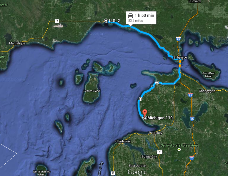
2 roads in Michigan for the price of one.
The tunnel of trees (m119) and U.S. Route 2.
|
Jonathan Harper
> Milky
02/25/2015 at 21:17 |
|
That looks amazing. Thank you!
|
Leadbull
> Jonathan Harper
02/25/2015 at 21:17 |
|
I embedded a map, but Kinja ate it apparently.
It was a joke, though. Rte. 165 is a cornfield.
|
Jonathan Harper
> Leadbull
02/25/2015 at 21:23 |
|
cornfields can be driven on/in
|
Leadbull
> Jonathan Harper
02/25/2015 at 21:25 |
|
MALACHI
|
Desu-San-Desu
> Jonathan Harper
02/25/2015 at 21:51 |
|
In that case, I have personally driven the majority of this map and, traffic permitting, it will be one of the best 12 hours of your life:
https://goo.gl/maps/4LAFY
!!! UNKNOWN CONTENT TYPE !!!
|
Jonathan Harper
> Desu-San-Desu
02/25/2015 at 22:00 |
|
Marvelous!
 Tim (Fractal Footwork)
> Jonathan Harper
Tim (Fractal Footwork)
> Jonathan Harper
02/25/2015 at 22:08 |
|
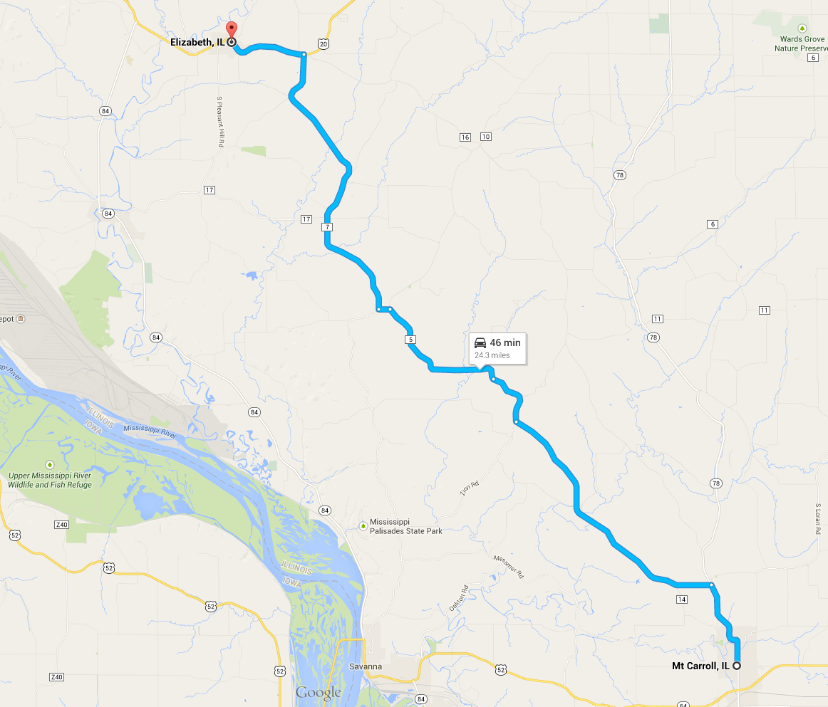
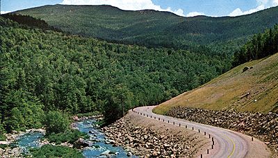
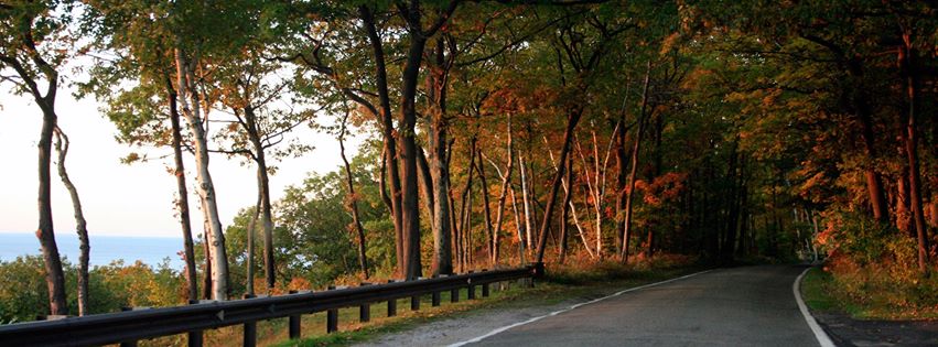
The road from Mt. Carroll, IL to Elizabeth, IL is my favorite road in the world.
The climb in elevation is quite staggering (for Illinois) with an elevation change of 1,467 ft. The hills are most beautiful in autumn and the area would probably rival that of the Appalachians. You can peak through the trees and see an almost helicopter-sightseeing-view of the farmland below before dipping back down into it.
If you do take this MAKE SURE that you go from Mt. Carroll to Elizabeth as the road gets perpetually better after each corner.
The first time I drove this was in my parents' sedan doing the limit; I knew it was a great road then, but driving this hard in my Genesis taught me that roads really change when you're on it 6-7/10ths.
The standout feature of this road that sticks in my head: sharp and long uphill straight leading to an uphill decreasing-radius blind corner. It's amazing.
No cops or real traffic, everybody takes Rt 20 which may have been a good road, but its way to crowded. Do watch out for farming traffic as there is a house/farm in particular that treats the area adjacent to the asphalt as its own storage area on both sides (slow down when you see someone and treat everybody real nice as I see it as me thankfully borrowing their land for my use; its a privilege, you can always come back and drive it again, though I'm sure you'll be polite and am more saying this for anyone else that I don't know through the tubes seeing this and wanting to wring it out.)
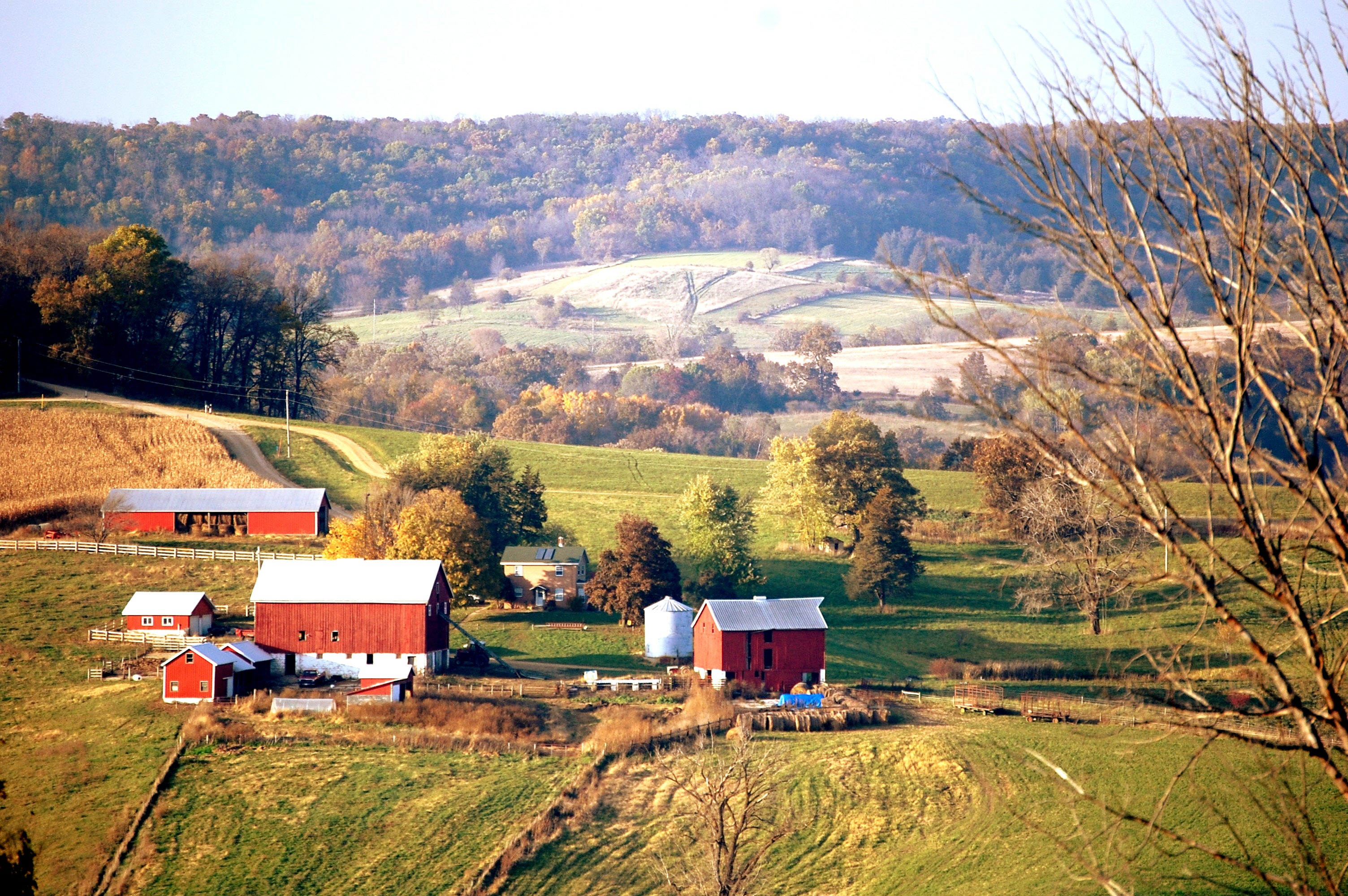
The area pretty much looks like this but with a bit more elevation (not my picture):
Enjoy. Let me know if you go, how it was.
 wafflesnfalafel
> saabstory | fixes bikes, breaks cars
wafflesnfalafel
> saabstory | fixes bikes, breaks cars
02/25/2015 at 22:09 |
|
Was going post Chuckanut and you beat me to it. Early Sunday mornings, the section north of the Chuckanut Manor restaurant to the main Larrabee State Park entrance. Not much room for error, and watch out for the occasional rock coming off the hillside, and bicyclists, and slow tourists, and deer, and don't get distracted by the awesome views...
|
Jonathan Harper
> Tim (Fractal Footwork)
02/25/2015 at 22:12 |
|
thank you!
|
Desu-San-Desu
> Jonathan Harper
02/25/2015 at 22:12 |
|
BTW, there's a mind-boggling selection of amazing roads in this entire area. That route isn't the only selection of great roads- it's one combination out of thousands, haha.
 HammerheadFistpunch
> Jonathan Harper
HammerheadFistpunch
> Jonathan Harper
02/25/2015 at 22:13 |
|
That one.
|
HammerheadFistpunch
> Jonathan Harper
02/25/2015 at 22:14 |
|
for all seriousness though, check out scenic byway 12 in utah...pretty much anywhere in that area is driving heaven.
|
HammerheadFistpunch
> norskracer98-ExploringTheOutback
02/25/2015 at 22:15 |
|
great one, but crowded (often) and...still under construction I think?
|
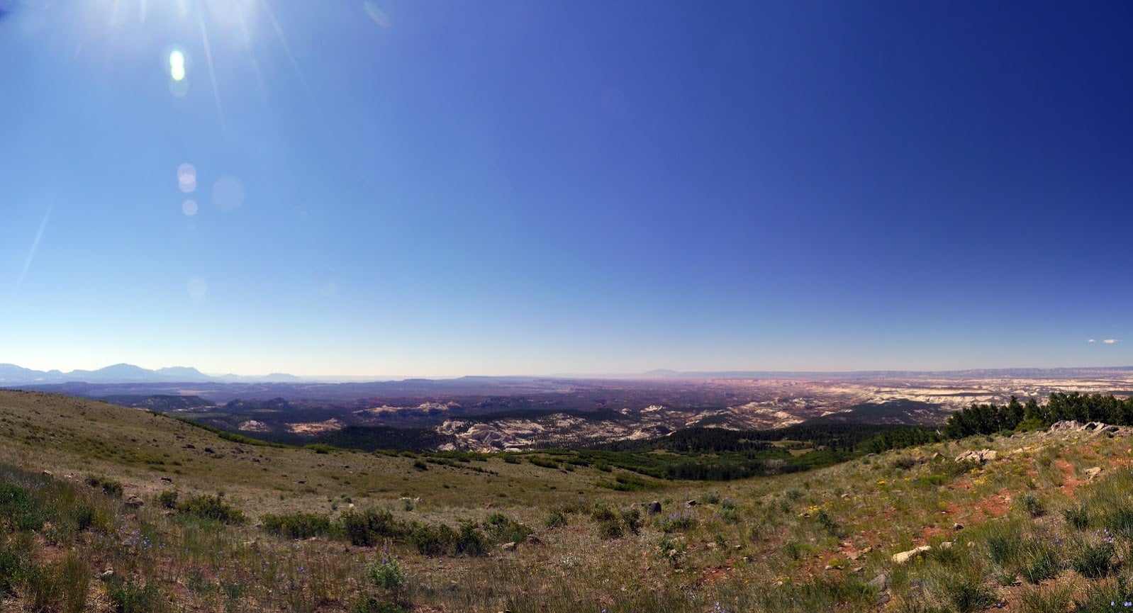
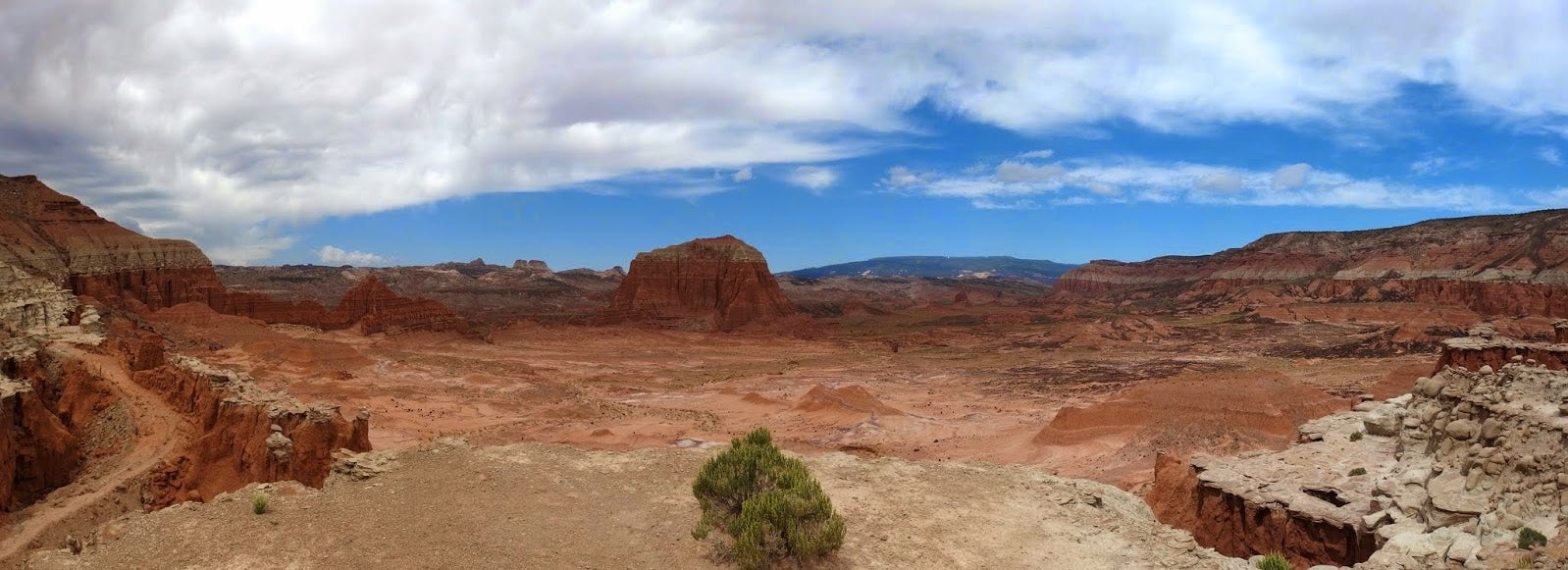
HammerheadFistpunch
> Jonathan Harper
02/25/2015 at 22:33 |
|
There are 100 of the most amazing places off this route.
You can pick and choose and there are some amazing dirt roads in there.
a few shots literally on the road in blue
 davesaddiction @ opposite-lock.com
> Jonathan Harper
davesaddiction @ opposite-lock.com
> Jonathan Harper
02/25/2015 at 22:51 |
|
NW Arkansas is pretty fantastic...
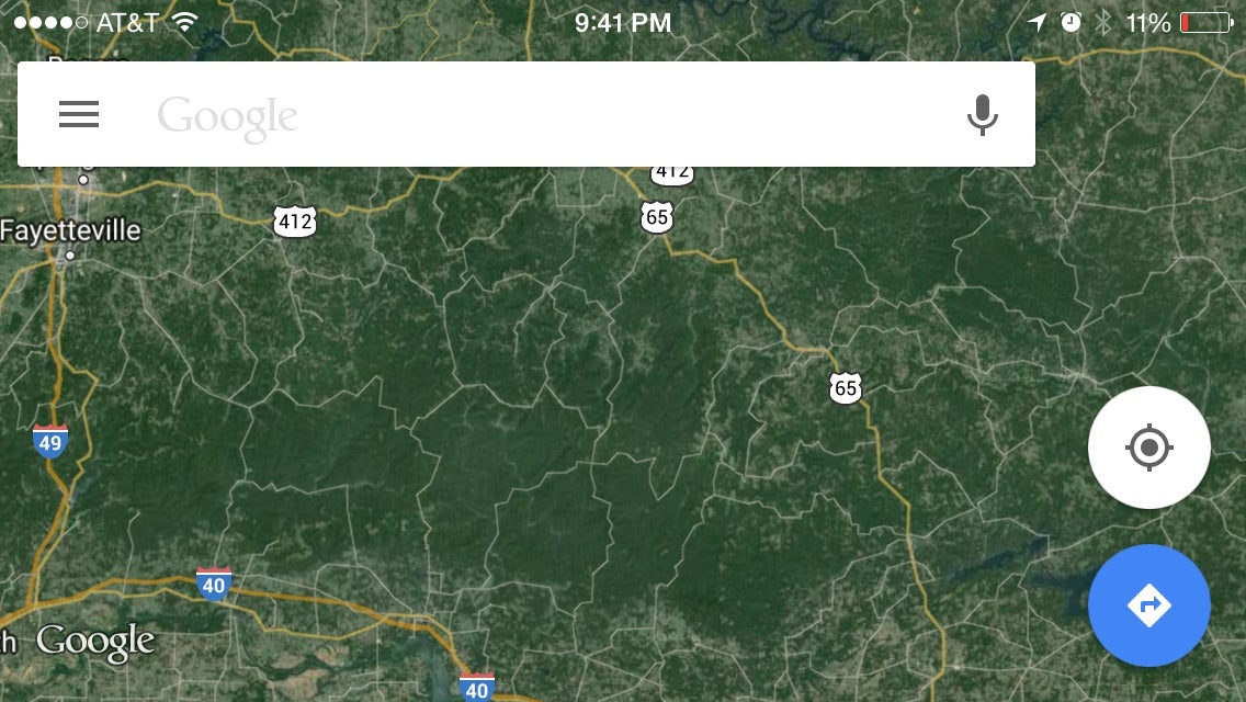
 Nick George
> Jonathan Harper
Nick George
> Jonathan Harper
02/25/2015 at 23:08 |
|
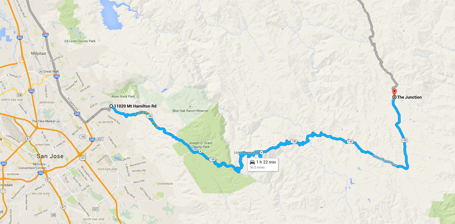
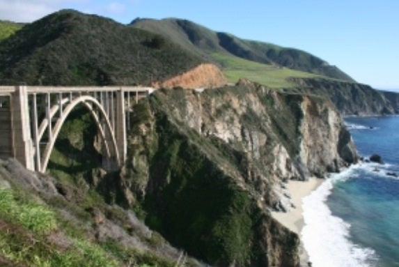
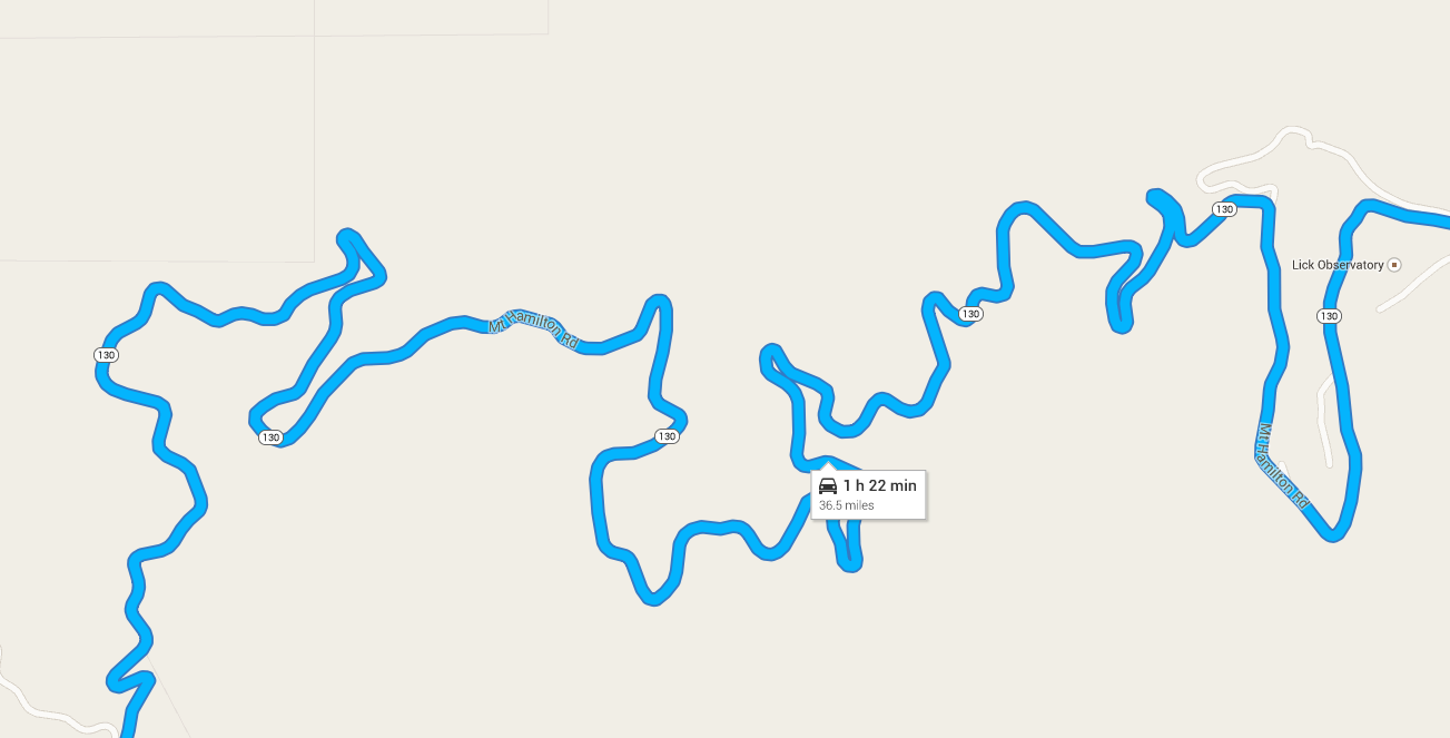
I just posted about this road a few days ago: Mt. Hamilton Road, east of San Jose, CA. Climb 4200 feet to the summit, stop and enjoy the views at Lick Observatory, then continue down the back side of the mountain to a country bar and grill called The Junction, literally in the middle of nowhere. The climb to the top has some insanely technical sections (below), and the back side is more high speed canyon-like runs.
|
Jonathan Harper
> HammerheadFistpunch
02/26/2015 at 00:03 |
|
ooh yes thanks
|
Jonathan Harper
> Nick George
02/26/2015 at 00:05 |
|
SWEET! thank you
|
HammerheadFistpunch
> HammerheadFistpunch
02/26/2015 at 00:10 |
|
here is the referenced map
 1.21 JIGGA WATTS!!!
> Jonathan Harper
1.21 JIGGA WATTS!!!
> Jonathan Harper
02/26/2015 at 08:31 |
|
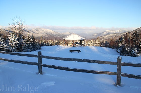
Iron Mountain Road in the Black Hills of South Dakota
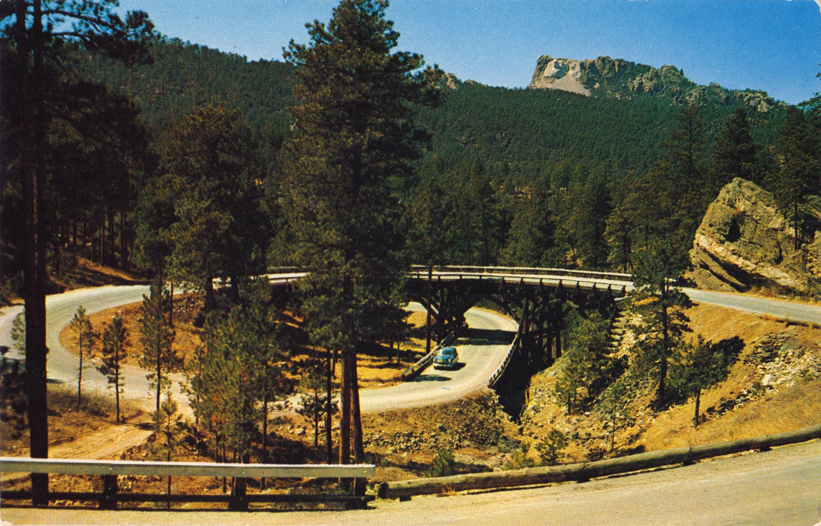
The pigtail bridges are pretty damn awesome
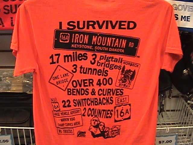
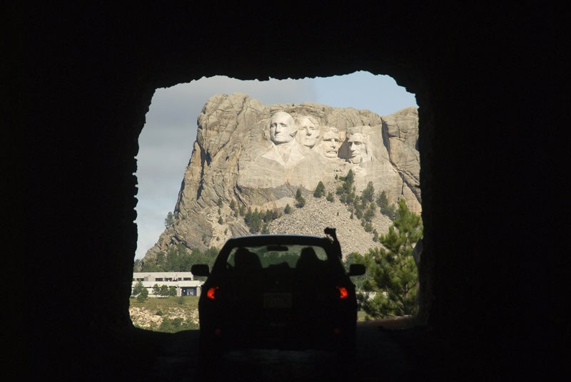
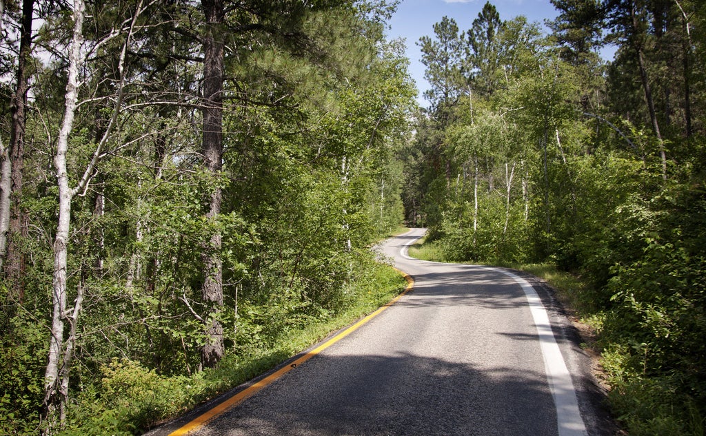
In two spots the road actually splits to go around trees and stuff...
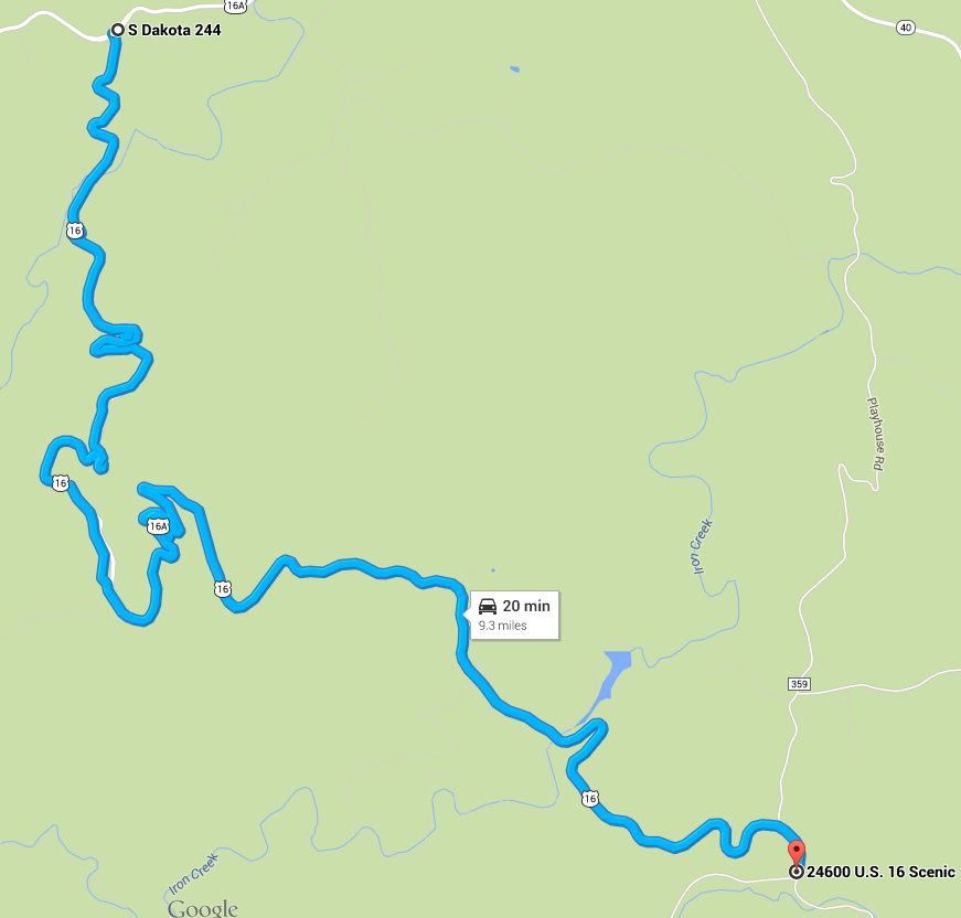
Only concern is the immense amount of traffic on the road in the summer. SD is a huge tourism state, so a lot of people visit the roads and Black Hills
|
norskracer98-ExploringTheOutback
> HammerheadFistpunch
02/26/2015 at 15:11 |
|
Construction for what? Haven't followed anything about it recently.
|
HammerheadFistpunch
> norskracer98-ExploringTheOutback
02/26/2015 at 15:12 |
|
I swear they are always working on it.
|
norskracer98-ExploringTheOutback
> HammerheadFistpunch
02/26/2015 at 15:13 |
|
Probably, seem to get a lot of ice and snow there so it makes sense.
 Birddog
> Tim (Fractal Footwork)
Birddog
> Tim (Fractal Footwork)
02/26/2015 at 19:10 |
|
I've been lost on that stretch more than once.
My ex-inlaws had a Farm in the Mt. Morris/Polo area. There are a lot of sweet backroads (gravel, chip seal and paved) there to "get lost" on.
|
Tim (Fractal Footwork)
> Birddog
02/26/2015 at 19:33 |
|
I'm planning on just going out there with a full thank of fuel and "getting lost" sometime this summer.
|
Birddog
> Tim (Fractal Footwork)
02/26/2015 at 20:02 |
|
It's a great way to blow a weekend.
If you ever get a chance stop off at the Chana Tap off of 64.
 ly2v8-Brian
> Tim (Fractal Footwork)
ly2v8-Brian
> Tim (Fractal Footwork)
02/27/2015 at 00:05 |
|
I'll have to check this out sometime when I visit family in Freeport.